

Spring to Spring
Texas State looks to be part of a trail linking majestic springs from San Antonio to Austin
By Matt Joyce
Supporters of an ambitious plan to link San Antonio and Austin by hike-and-bike trail are racing to conserve land in the face of proliferating development along the Interstate 35 corridor. In the process, they’re collaborating with Texas State University to support a key section of the trail in San Marcos.
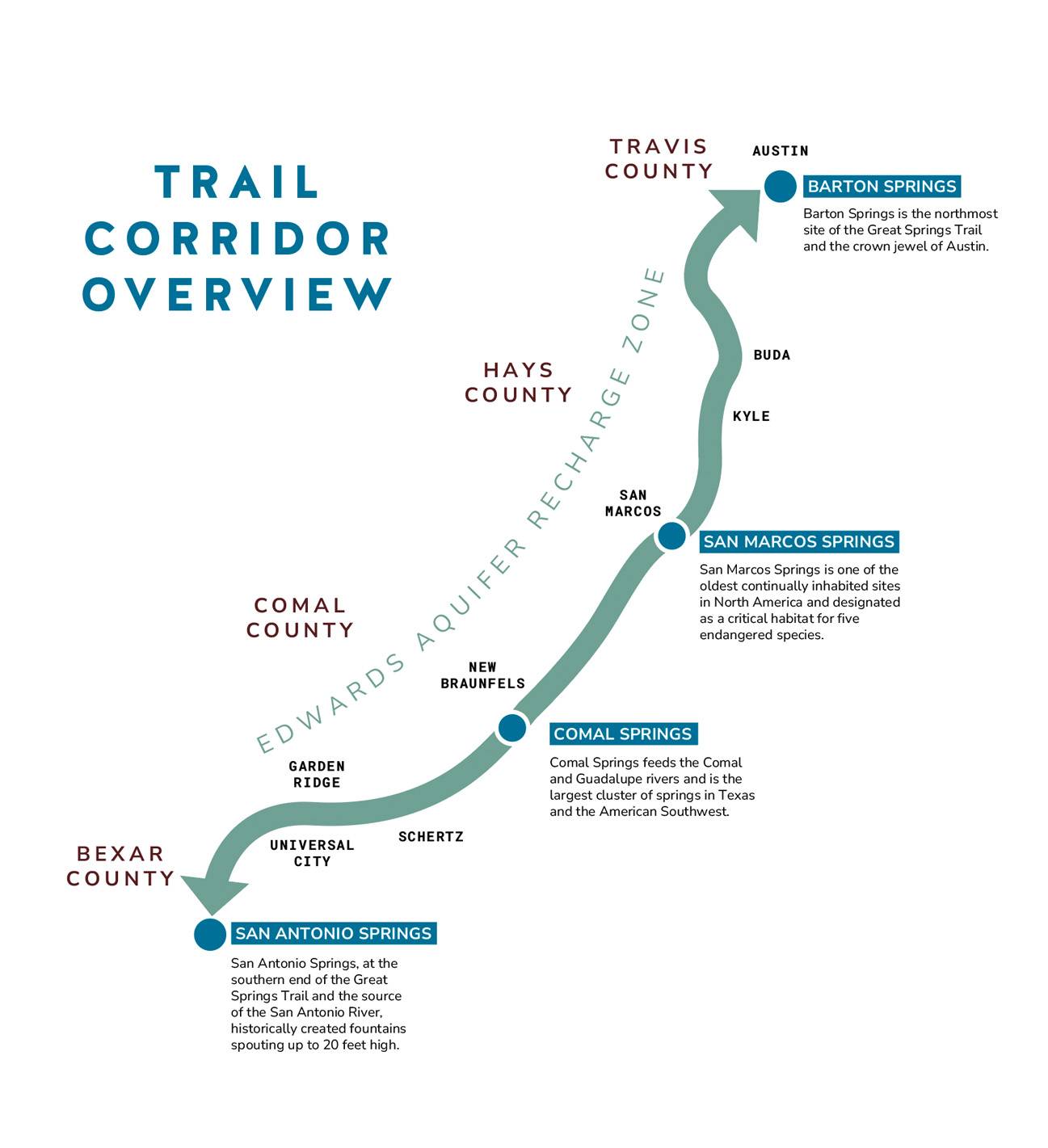
Great Springs Project formed six years ago to protect 50,000 acres in one of the fastest-growing regions in the country. Along this greenway, the project aims to create a continuous trail network connecting four vital springs — San Antonio Springs in San Antonio, Comal Springs in New Braunfels, San Marcos Springs on the TXST campus, and Barton Springs in Austin.
“Our tagline is ‘From the Alamo to the Capitol by 2036,’ which is the Texas bicentennial,” says Garry Merritt, the nonprofit’s CEO. “But the reality is we have less than 10 years to get this done before development washes over the potential to finish it.”
Great Springs Project is focused on preserving the Edwards Aquifer recharge zone, where water naturally filters through porous limestone to replenish the aquifer. The aquifer provides drinking water for 2.1 million people, including in San Marcos and San Antonio.
“All of our work is geared toward making people more aware of the Edwards Aquifer and its importance to ecology and to communities,” Merritt says. “These iconic rivers and the four springs are all possible because of the health of the Edwards Aquifer. If we lose that, we’re going to lose a big part of what makes Texas special.”
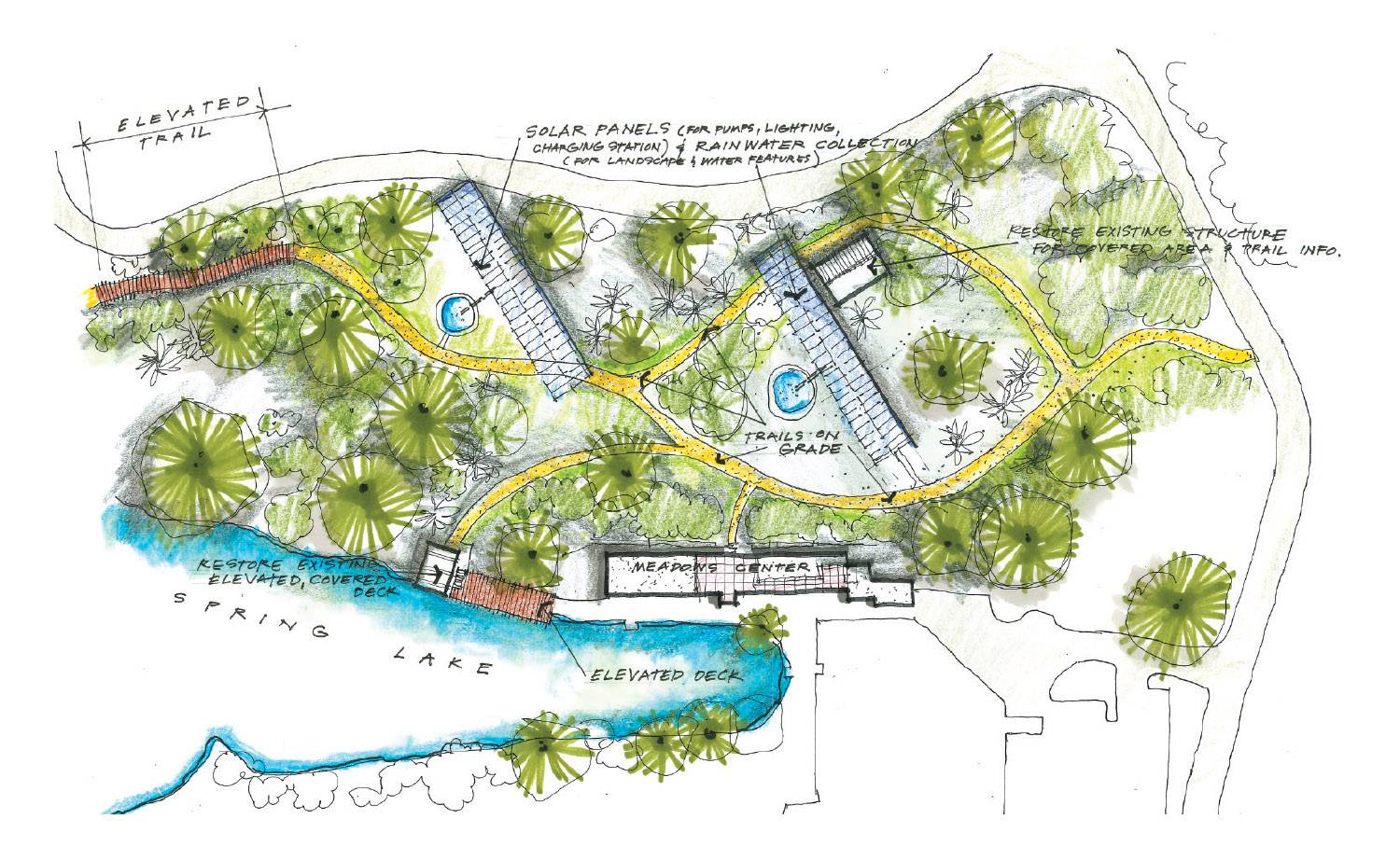
TXST has owned San Marcos Springs since 1991. The springs create Spring Lake, which is the headwaters of the San Marcos River and the home of TXST’s Meadows Center for Water and the Environment.
The effort to make San Marcos Springs an anchor of the trail coincides with Texas State’s development of its 2025-2035 Master Plan, which is a roadmap for campus facility and infrastructure improvements.
TGordon Bohmfalk, TXST’s director of Facilities, Planning, Design, and Construction, says the university’s goals align with those of the project. One of the master plan’s objectives is to better connect Spring Lake with campus. Currently, the only way to walk between the two sites is by roadways that skew away from the riverside.
“Spring Lake is not only a destination point for us in the current day, but it’s been that way for thousands of years,” Bohmfalk says, referring to archaeological evidence that Paleo Indians inhabited the springs as early as 8,000 years ago. “People want to be near the water, and we’ve got to figure out a way for people to get there.”
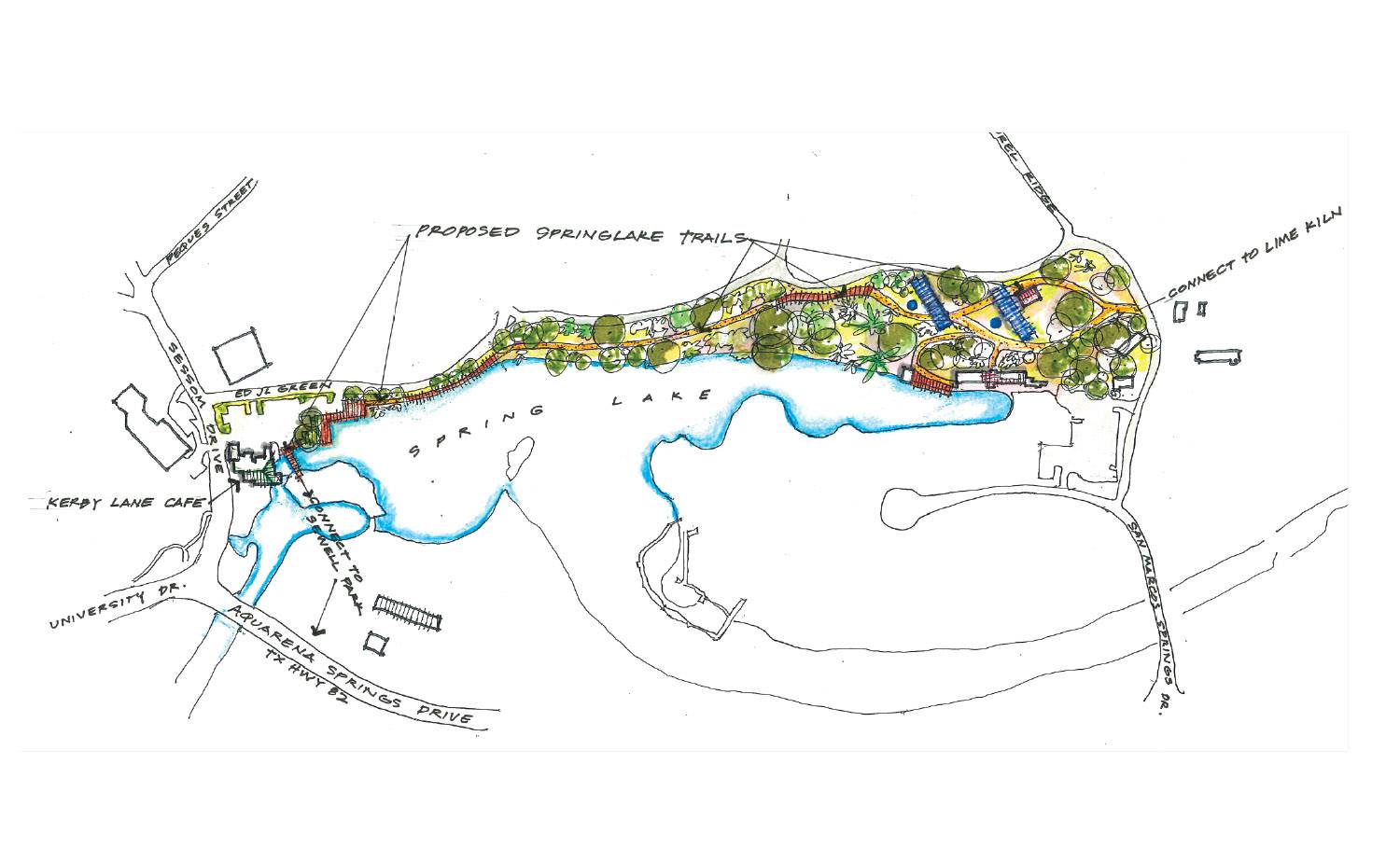
The master plan — which is still in its early stages — calls for building a trail on the northwest side of Spring Lake that would link to the trails of Spring Lake Natural Area. The new trail would include sections of boardwalk and hillside path along the lake’s steep embankment, leading to the corner of East Sessom Drive and Aquarena Springs Drive near Kerbey Lane Cafe. At that point, the trail would pick up in Sewell Park and connect to San Marcos’ City Park and the city trail that extends along the river.
Bohmfalk says navigating the busy intersection of Sessom and Aquarena Springs is complex. The master plan could consider reconfiguring the intersection, as well as an overhaul of Sewell Park, he says.
“How we jump over to Sewell Park is a challenge because these roadways and culverts are expensive to redo,” he says. “But it’s definitely part of our exercise right now because everybody wants to be there. Connectivity is super important.”
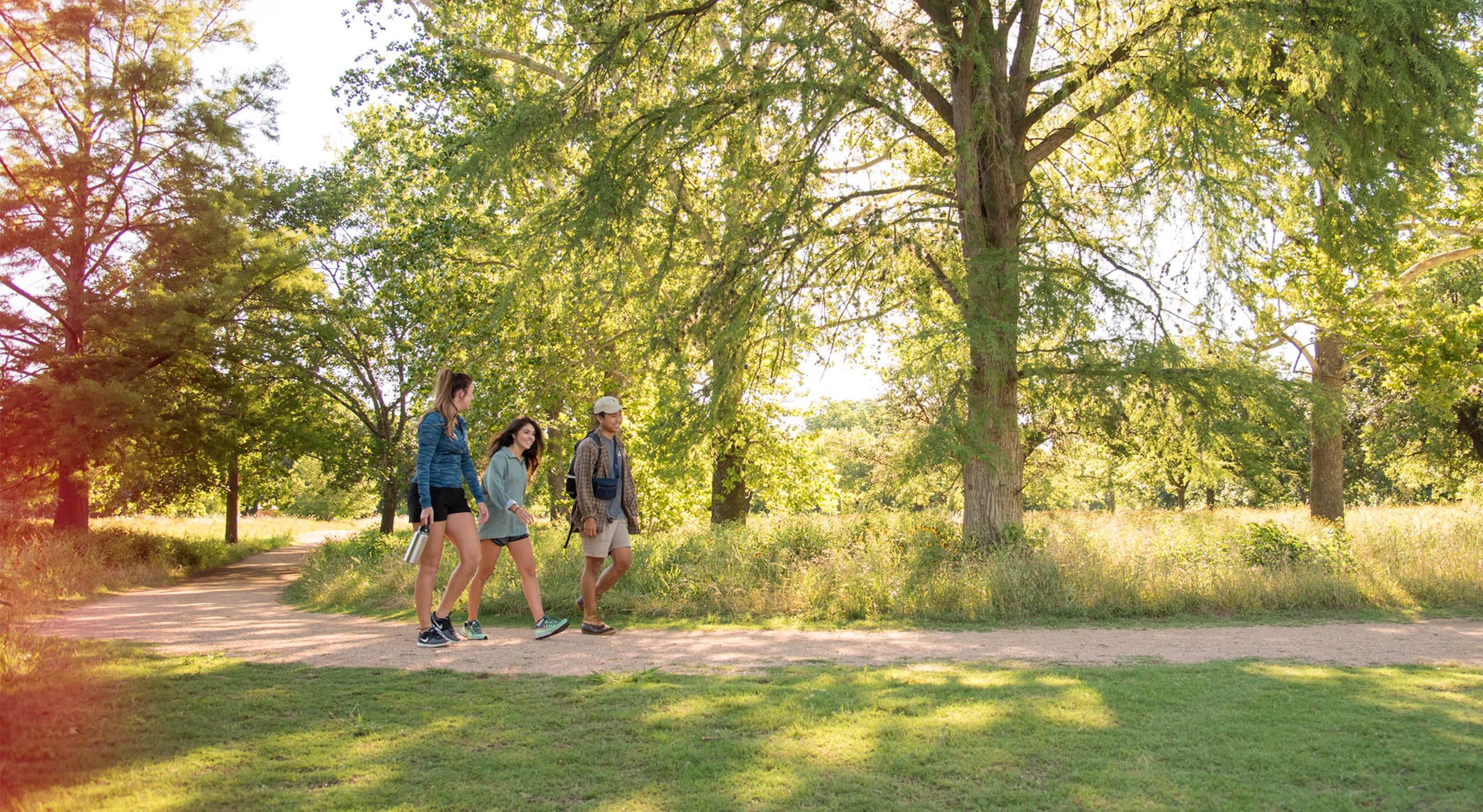
One of the biggest benefits of the Great Springs trail would be the promise of “nearby nature experiences,” says Anthony Deringer, Ed.D., an assistant professor of recreation administration. “Places that people can access on a regular basis and can build into their schedules, they go a long way in terms of building mental and physical health,” Deringer says.
Merritt says most of Great Springs Project’s work is filling the gaps between existing trail systems in cities along the route. Of the proposed 100-mile trail, about 40 miles are already on the ground; government and private developers have obtained trail right of way for another 30 miles; and the project is in discussions with landowners to acquire the remaining 30 miles of corridor.
In November, Great Springs organized a forum at TXST to discuss the project’s collaboration with the university and other parties to complete the trail network, and to engage the community in the myriad challenges and benefits of the mission.
“The springs and the San Marcos River are such an important part of the life of the university and the community,” Merritt says. “They represent the reasons that we work to make sure that we have a healthy aquifer for natural resource protection and recreation.” ★